5 Hrs
المصدر:
تونزي تيليغراف
تونزي تيليغراف
جاهز للتشغيل
جاهز للتشغيل
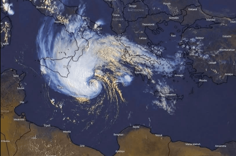
Forecasts indicate the potential formation of a strong moderate atmospheric system between Tunisia and Libya during September 13-14, 2026. This is due to the convergence of cold air in the upper layers with the warm Mediterranean Sea waters, which could lead to the development of a cyclone resembling a tropical hurricane. This system may bring heavy rains, strong winds exceeding 120 kilometers per hour, and high waves, with varying impacts on the region: Malta and southern Italy are likely to be the most affected, while Tunisia's impact remains limited for now. Weather models differ in their predictions regarding the final trajectory of the system, which could shift westward, eastward, or stay over the sea, making the certainty of a moderate hurricane still uncertain. Continuous monitoring of upcoming weather developments is essential.
تنويه: هذا ملخص تم إنشاؤه بواسطة الذكاء الاصطناعي



comments.heading