24 Hrs
Source:
سواليف
سواليف
Ready to play
Ready to play
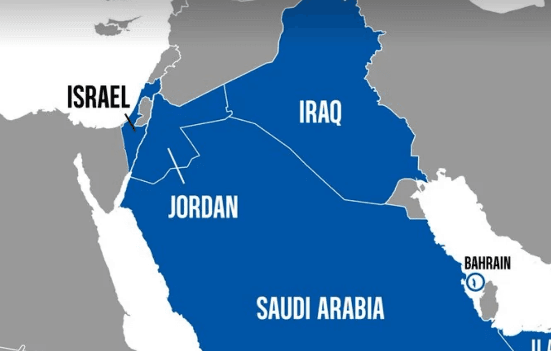
The U.S. Central Command (CENTCOM) confirmed that it circulated a map during a ten-day tour by its commander, Admiral Brad Cooper, showing the West Bank and Gaza Strip within the area representing Israel, without clear borders for Palestinian territories. The map was later modified to depict the West Bank and Gaza separately from Israel, according to the borders prior to the 1967 war, but no reasons were provided for the change. This incident comes within the ongoing debate surrounding the status and borders of Palestinian lands, especially amid differing American positions on the Israeli-Palestinian conflict.
Notice: This Is an AI-Generated Summary







Comments (0)